Route overview
A 20 mile on road route through beautiful Sussex countryside and downland villages. A great route with a few big ups and great downhill stretches with open views. Lots of options for refreshment stops with country pubs and Compton Village stores and cafe to choose from.
Route description:
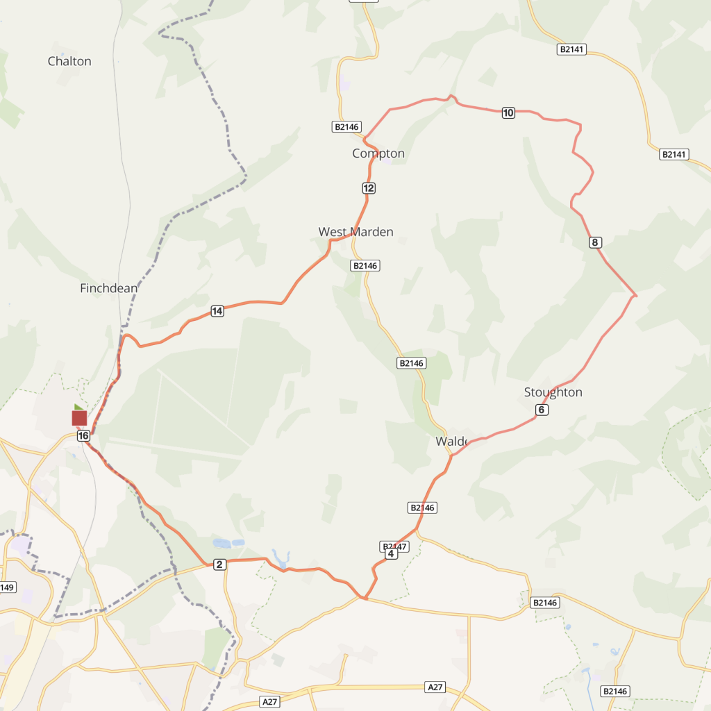
- From Rowlands Castle Station turn left into the village and then go straight ahead under the railway arch. Follow signs towards Stansted and Westbourne.
- At the end of the road, turn left at the junction and stay on this road. After about a mile take the left hand turn towards Walderton.
- Turn left and join the main B2146 for three quarters of a mile (this is a faster busier stretch) then turn right into Walderton village. The Monarch’s Way, a long distance (over 600 miles!) footpath crosses here – making the Barley Mow pub with its skittle alley a very welcome sight.
- Continue on this road through Walderton and Stoughton villages and follow the road around the sharp left hand bend and up the hill to East Marden. Turn left before the church.
- At the next crossroads turn left and climb up a short steep hill; there are great views from ridge at the top.
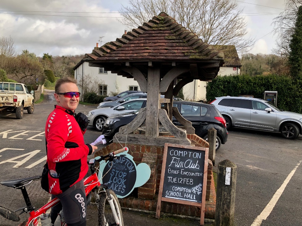
- Descend the other side and take a left turn at a crossroads and left again at the end and into Compton village.
- After leaving Compton continue south for less than a mile, turning right into West Marden, notable for its thatched well and a church organ once owned (and played) by Prince Albert. Philosopher Bertrand Russell lived here briefly too (little known and useless fact: he and George Bernard Shaw crashed into each other on their bikes in 1895, making news headlines. In the same year a list of ‘don’ts’ for women cyclists include ‘Don’t refuse assistance up a hill’ and ‘Don’t cultivate a bicycle face’)
- Anyway, carry on up a short steep climb (accepting all the assistance you can get) out of West Marden village and follow the road through Forestside and on to Deanlane End.
- The road goes round a sharp left hand bend and continues back to Rowlands Castle.
- Turn right under the railway arch and right again into Bowes Hill Road to return to the railway station.
Distance
20 miles on road
Time
3 hours +
Level
Strenuous
Elevation
817 ft climbs / 688 calories
Start and End
Rowlands Castle
PlusBike
Planning your combined cycle and rail journey
Travelling by rail with a bike
what are the restrictions?