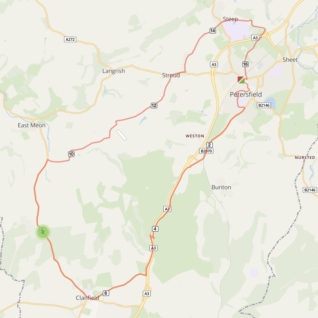
Route overview
This circular route includes an optional stop-off at the Sustainability Centre cafe, on the South Downs Way. There are a couple of long steep climbs and several shorter ones with descents offering great downland views.
Route description:
- Go down Lavant Street from Petersfield Station. At the cross-roads turn right in to Charles Street and follow blue cycle signs for the Shipwrights Way to Queen Elizabeth Country Park heading south.
- Continue to follow Shipwrights Way signs along The Causeway for two miles. The route is a mixture of on road and shared use cycleway. Pass the Shipwrights Way signs to Buriton and carry on over the Buriton roundabout.
- Take the cycle path on your left by a metal gate and bollards before you get to the A3 dual carriage way. The path on the disused old A3 route goes up a hill past a quarry and down into QE Park.
- When you get to the Country Park turn right to go back the road and look for cycleway signs for Sustrans route 222 to Havant and follow the path alongside the A3.
- The cycleway joins the old London Road. Follow this for about half a mile and turn right onto the Old Petersfield Road signed to Butser Hill.
- At the end of Petersfield Lane turn right into Clanfield village.
- Just past the Rising Sun pub take the right turn towards East Meon and follow brown signs to the Sustainability Centre. Where the road forks, bear right up Hyden Farm Lane, a good climb up into the tree line.
- At the top of the hill the road arrives at a junction of routes and meets the South Downs Way route. There are two options at this crossroads junction.
- Option 1: For Sustainability Centre turn left on to the Droxford Road (South Downs Way) for approx 1/2 mile (700m), the entrance is on the left. A good place to replenish water bottles. To return, retrace route to the crossroads junction and turn left downhill towards East Meon.
- Option 2: If NOT going via Sustainability Centre at the cross roads continue down the hill following signs for East Meon.
- Enjoy the descent and open views. After a cluster of farms, turn right on to Oxenbourne Lane, carry on along this road for about a mile and a half, avoiding other turns. Follow signs for Ramsdean.
- Carry on following signs to Ramsdean past the Frogmore turn. Take the second road on
- Follow this leafy lane into the hamlet of Ramsdean, and take the right turn signed to Petersfield, continuing to the junction with the A272 at Stroud.
- Turn right on to A272 (a busy road) for a quarter of a mile then take the first left as the road bends to the right, up Ridge Common Lane and follow signs to Steep.
- At the crossroads with Bell Hill go straight ahead into Church Road. Carry on through Steep village and down the steep wooded lane.
- At The Harrow Inn (serial winners of Unspoilt Pub of the Year) turn right on to Sandy Lane and follow signs for the Shipwrights Way back to Petersfield Railway Station.

Distance
16.5 miles (26.5 kms)
Time
1.5 hours
Level
moderate
Elevation
1286ft / 700 calories
Start and End
Petersfield
PlusBike
Planning your combined cycle and rail journey
Travelling by rail with a bike
what are the restrictions?