Route overview
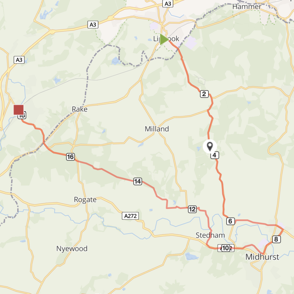
Long and at times strenuous route starting in Liphook and ending one station down the line at Liss. Takes you on an easterly loop past Hollycombe Steam Collection to Woolbeding Common, through deep and peaceful lanes down to Midhurst and back, with views of the South Downs.
Optional Detour Sharp left hand turn on to Older Hill Lane. About half a mile uphill on single track lane, there is a carpark and fantastic viewpoint over the Sussex Countryside. This is Woolbeding Common, with some great off-road tracks.
Route description:
- From Liphook station, turn right on to Station Road and then right again at the T-junction, following signs to Hollycombe and Midhurst. Take care on the narrow bridge over the railway (poor sight lines).
- After about a mile the road passes Hollycombe then carries on under the gothic 19th Century stone bridge which is part of the historic estate.
- Carry on down the hill on a lovely rhododendron and beech-lined road for about a mile and a half, withglimpsed views of the Downs to your right, following signs to Midhurst. Take the left turn signed for Linch Church, St. Luke’s is approx 1/4 mile on the right.
- Continue on along Linch Road through Redford towards Woolbeding.
Optional Detour: 1.4 miles each way
Sharp left hand turn on to Older Hill Lane. About half a mile uphill on single track lane, there is a carpark and fantastic viewpoint over the Sussex Countryside. This is Woolbeding Common, with some great off-road tracks.
To Midhurst Refreshment and rest stop at 8 miles. Challenging. - Linch Road turns into Woolbeding Road and becomes the single track Brambling Lane. Follow this to Woolbeding. As you enter the village take the left turn signed to Easebourne and carry on along Hollist Lane for 1.5 miles where this single track lane meets the main road A286.
- Cross this busy crossroads junction. Carry on straight ahead into Wheelbarrow Castle at the junction.
- Wheelbarrow Castle meets the busier A272. For Easebourne village turn left and then next left into Easebourne Street. For Cowdray Farm Shop and cafe take the next right towards the polo fields.
- To go into Midhurst town centre, turn right at the end of Wheelbarrow Castle and follow over a couple of roundabouts and on to the High Street, over an ancient stone bridge. Views of the Cowdray Ruins here (there’s also a well-hidden little wild swim place just in front of the ruins, on the river Rother).
- For a circuit of old Midhurst continue up the High Street and take the left turn just in to Knockhundred Row which takes you up Church Hill. A nice area to explore, rest or eat.
- Turn right after The Swan Inn and cross the oncoming traffic into West Street, take the second turn in to Wool Street which takes you to the Wheatsheaf pub. At the end dismount and walk back towards the centre of town, across the road. Take the next left on to June Lane – there’s a blue cycleway sign saying Stedham 20mins.
- Carry on up the narrow lane to the end where it joins the busy A272 at the Moon Pub; the cycleway is a shared use path just before you join the main road. It crosses the A272 at a dropped kerb and continues alongside the main road.
- The shared use path is single file width in places. There is a crossing place with pedestrian refuge just before the sign for Stedham. Cross the A272 here then join The Street which takes you into Stedham Village (where there’s a great pub and Thai restaurant).
- Continue on Stedham Lane over the narrow bridge across the River Rother and up a wooded single track lane until a signposted junction. Follow signs towards Iping on Stanwater Lane, a steep climb, and then take the left turn on to Hammer Lane signed to Chithurst. There are some long climbs up a very narrow and deep beech-banked lane with limited passing places and rough surfaces along some sections.
- Take the right hand turn on to Chithurst Lane as the lane bends to the left, there is a view across the fields here. Turn left at the next main junction signed to Borden Wood and follow up the hill around a sharp left hand bend to meet the Dangstein Road signed to Rake and Liss.
- Continue on this road for over two miles crossing all junctions to meet the main road at Hillbrow by the Jolly Drover pub, a long gradual sweet chestnut-lined climb.
- Go straight across this staggered crossroads junction, following signs for Liss. It is a fast descent into Liss on a busier road. At the Whistle Stop Pub roundabout take the first exit to the left and Liss Railway Station is on the right.

Distance
19 miles on road
Time
2 hours +
Level
strenuous in parts
Elevation
886 ft climbs / 770 calories
Start and End
Liphook / Liss
PlusBike
Planning your combined cycle and rail journey
Travelling by rail with a bike
what are the restrictions?